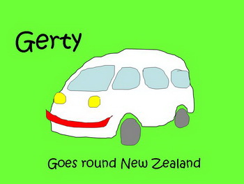
Join us on our trip around New Zealand
in our tubby travelling home, Gerty
Central South Island
East Coast
Part Four
| |
| HOME |
| About Tenaya |
| About Us |
| Latest Update |
| Logs from Current Year |
| Logs from Previous Years |
| Katie's View |
| Route Map |
| Links |
| Contact Us |
![]()
February 12, 2011
Difficult as it was to leave the spectacular coastline of dense green mountains, amber sandy beaches and sparkling emerald waters of the Abel Tasman and Golden Bay area, we were happy to be on the move again. In this respect this touring around New Zealand business is very much like our sailing life.
Gerty skirted the northern coast of the South Island back to Nelson before cutting down to Blenheim on the eastern coast. The vast valley of vineyards surrounded by mountains was quite different than the pockets of vineyards in Mendocino, Sonoma, Napa and Alexander valleys of our home state of California.
The seaside town of Kaikoura was our next destination. Its main attractions are whale watching and swimming with dolphins. No need to pay for those things now! We're still caught up in the idea we need to see all the "sights" but this seemed like a wasted stop so maybe we will shed our lemming mentality.
While planning our route last month we were quite happy to skip the spa town of Hanmer Springs but after kayaking three days, shoving whales upright and digging trenches around them with buckets, our aching muscles begged to soak. It was awesome!
Pools of various temperatures, mineral contents and features abound. Our favorite, after the hot and nearly natural pools, was the one that had every range of hose nozzle spray: round stream, flat stream, shower spray and even waterfall. Aahhh... almost as good as a massage! We awoke the following morning completely refreshed. It's a quaint town nestled in the foothills of the Southern Alps, a lovely location with many walking tracks. Even the holiday park had a pleasant, rustic ambiance.
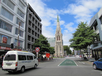
Following the coast south we drove through Christchurch and on to Lyttleton, the northern gateway to the Banks Peninsula. Compact but brimming with character, this working port town has an interesting mix of hip cafes and restaurants sandwiched between shipping agents, warehouses and funky boutiques.
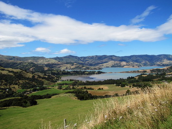
Three ancient volcanos make up the Banks Peninsula. named for Joseph Banks, Captain Cook's botanist aboard the Endeavour. Two are sunken with harbors in them, Lyttleton and Akaroa.
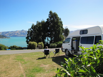
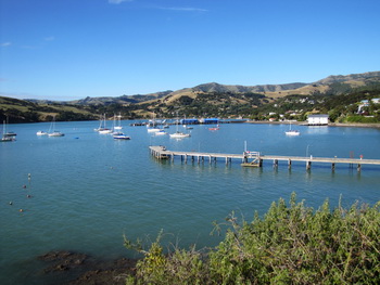
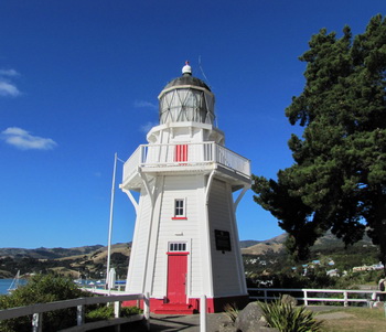
We wound our way around the rolling, grass covered flanks and then up and over to the south eastern tip where the pretty, French influenced town of Akaroa lies. Tastefully touristy, cafes, boutiques and small accommodations line the main street along the shore. High on the hill above town, our campsite looked over the gorgeous harbor where a restored lighthouse stands beyond sailboats lying peacefully on mooring balls. Looks like a wonderful place to bring Tenaya!
After more than twenty years of silence on the subject, Jim began to complain about cold feet. Stumbling across an ad for a sheepskin footwear factory, he announced we were stopping there on the way to our next destination, Mt. Cook.
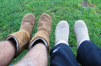
We were thrilled with the selection and both bought comfy, warm boots and were enchanted with our only NZ souvenirs. Cutting out the tag I read that the boots were assembled in China with sheepskin from NZ or Australia. Jim was gobsmacked. "But they called it a factory!" We laughed at being duped but have toasty toes nonetheless.
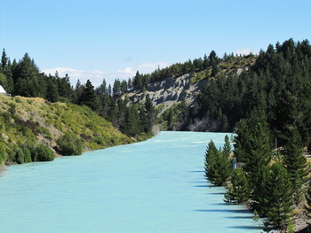
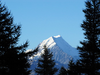
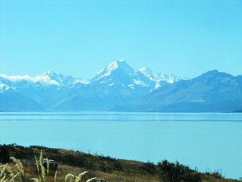
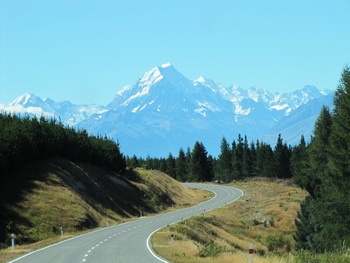
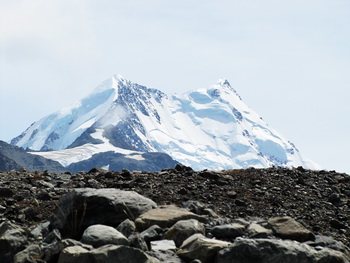
Scenic highway 72 curves inland passing through valleys and plains and small towns in the shadow of the Southern Alps, a pleasant alternative to the straight thoroughfare of coastal Route 1. We followed it until we reached Geraldine when we turned inland to pass the glacier-fed pale blue Lake Tekapo and river en route to Aoraki Mount Cook.
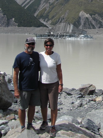
After a full day of driving the sky was still brilliantly blue when we arrived at Mount Cook late in the afternoon. Our first stop was the Old Mountaineers Cafe to sign up to kayak on Tasman Lake the following day. Then we visited the extensive information site and learned some of the geological and mountaineering history of this spectacular section of the Southern Alps.
Though he grew up near Auckland, Sir Edmund Hillary did much of his early climbing around Aoraki Mount Cook Village. Most famous for his ascent of Mt. Everest in 1953 with Tenzing Norgay, he was widely admired for his humanitarian work in Nepalese villages.
Quoting Lonely Planet, "Hillary embodied the qualities Kiwis hold most dear: hard-working, straight-talking, honest and, most of all, modest.
He returned in 2003 to officially open the Old Mountaineer's Cafe but died just a few days after the Sir Edmund Hillary Alpine Center opened its doors in 2008.

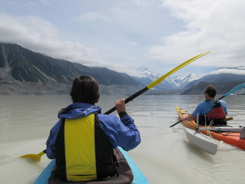
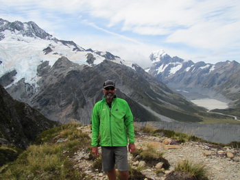
The water is cold, 2 C on the surface and 0.5 C a bit deeper in Tasman Lake at the foot of the Tasman Glacier. Kayaks are fitted with balancing pontoons similar to training wheels on a child's bicycle. They seemed silly at first until I felt the frigid water and was happy for the added security.
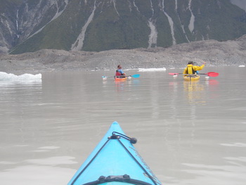
Thirty year ago this 250 meter deep lake did not exist. The Tasman Glacier extended six kilometers down to the terminal moraine which now contains the lake. The speed of the retreat is frightening.
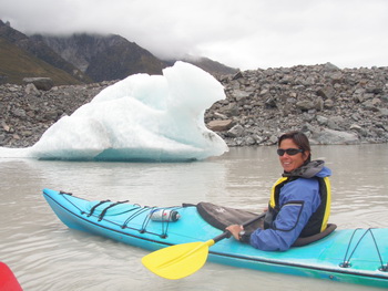
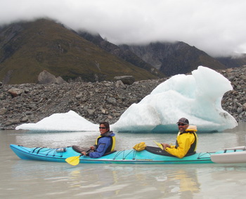
There were a couple of large icebergs in the lake which Tom, our excellent guide, wouldn't let us near for safety reasons but we were able to approach the smaller ones once he'd checked them out. 90% is underwater so it is important to be vigilant when paddling near them.
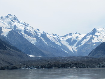
We paddled down towards the glacier but stopped well ahead of the 100 meter wall. As glaciers are continuously moving, ice could calve at any time. Also, a shelf extends below the water making approaching the wall treacherous and foolhardy.
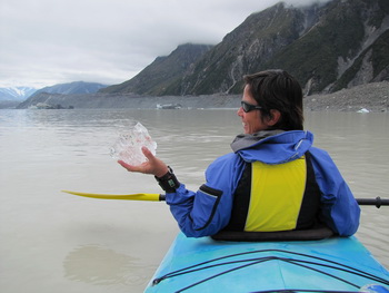
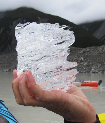
Chunks of ice in various sizes floats on the cloudy lake. This ice is 10,000 years old! Amazing! And the water is so pure it's possible to drink straight from the lake. No need for water bottles!
The morning was calm and gray with cumulus clouds resting in the valleys and obscuring the peaks. The monochromatic scene was surrealistic.
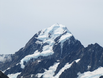
Near the end of our adventure the clouds burned off and we were treated to an awesome view of the Caroline Face and South Ridge of Mount Cook. What a great way to end a fantastic experience!
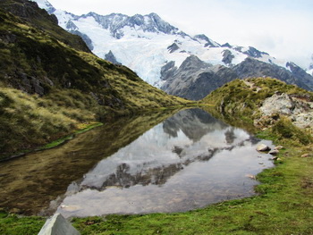
The ring around the sun warned of not-so-nice weather approaching so we ditched the plan to see the fabulous Sir Edmund Hillary Alpine Center that afternoon in favor of spending time outdoors. Tom suggested a hike up to Sealy Tarns and on to Mueller Hut for the night but as we'd already paid for a campsite (should never do that in advance!) we settled for hiking up to the tarns.

It was a steep hike up rock steps to the tarns but what an incredible view! We sat admiring the icefalls on Mt. Sefton and realized we'd forgotten the ominous sound of creaking ice. How great it felt to be back in the mountains though our hearts and lungs protested somewhat!
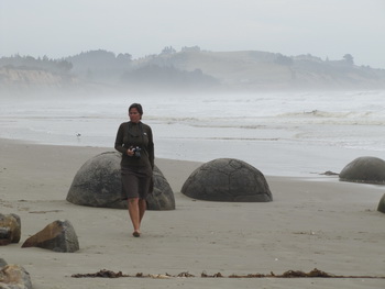
The next day Gerty took us further south and back to the eastern coast to the town of Oamaru. We went in search of penguins but found the center way too commercial and touristy so continued to the Moeraki Boulders.
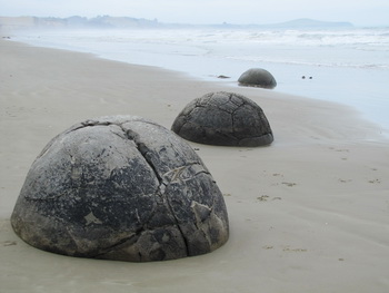
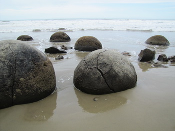
Muddy sediment containing shell and plant fragments accumulated on the sea floor. 60,000 years ago the boulders were formed around a central core of carbonate of lime crystals that attracted minerals from the sea floor.
The boulders fell as mudstone cliffs eroded, resting on the beach like giant marbles. More weathered boulders reveal a honeycomb pattern of veins and some broken ones show various colors inside.

We have now passed through Dunedin and are nestled for the night in the small town of Portobello on the Otago Peninsula. Steady rain is pattering on Gerty's roof.
Go to February 2011 Part Five - Otago Peninsula & The Catlins